You’re in a crowded street with many high buildings around you and you find your car position on Google maps is wrong. That’s usual, right? This is caused from (fake/distorted) GPS signals reflected from the high buildings around you which make your GPS receiver do some wrong calculations.
Even with no wrong calculations, the current GPS accuracy is about 5 meters, but this is going to change in next year 2018; where, a new set of satellites with enhanced GPS signals will be available for public use.
The enhanced GPS signal can make the GPS receivers do position calculations with 30-centimeter accuracy instead of today’s 5 meters. Moreover, it solves the problem of reflections inside crowded area with buildings with narrow window to the sky.
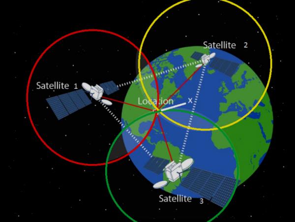
The global navigation satellite systems: Europe’s Galileo, Russia’s Glonass, China’s Beidou and US’s GPS transmits information about its position, the current time and more. The receiver, then, uses these signals to calculate the distance from each satellite based on how long the messages took to arrive. However, knowing the distance from 3 satellites is enough to calculate the position using geometric process called trilateration. This message broadcasted by a satellite called L1 signal. where, L band is a range of frequencies from 1 to 2 gigahertz.
The next generation set of satellite will broadcast, in addition to L1 signal, a higher frequency signal called L5; where, GPS signal carriers are in the L band and are centered at 1176.45 MHz for L5 and 1575.42 MHz for L1. The following image is going to explain why the new signal can solve the old problem of reflections
Read More: 2018 WILL MARK A MILESTONE IN GPS TECHNOLOGY WITH 30-CENTIMETER ACCURACY

